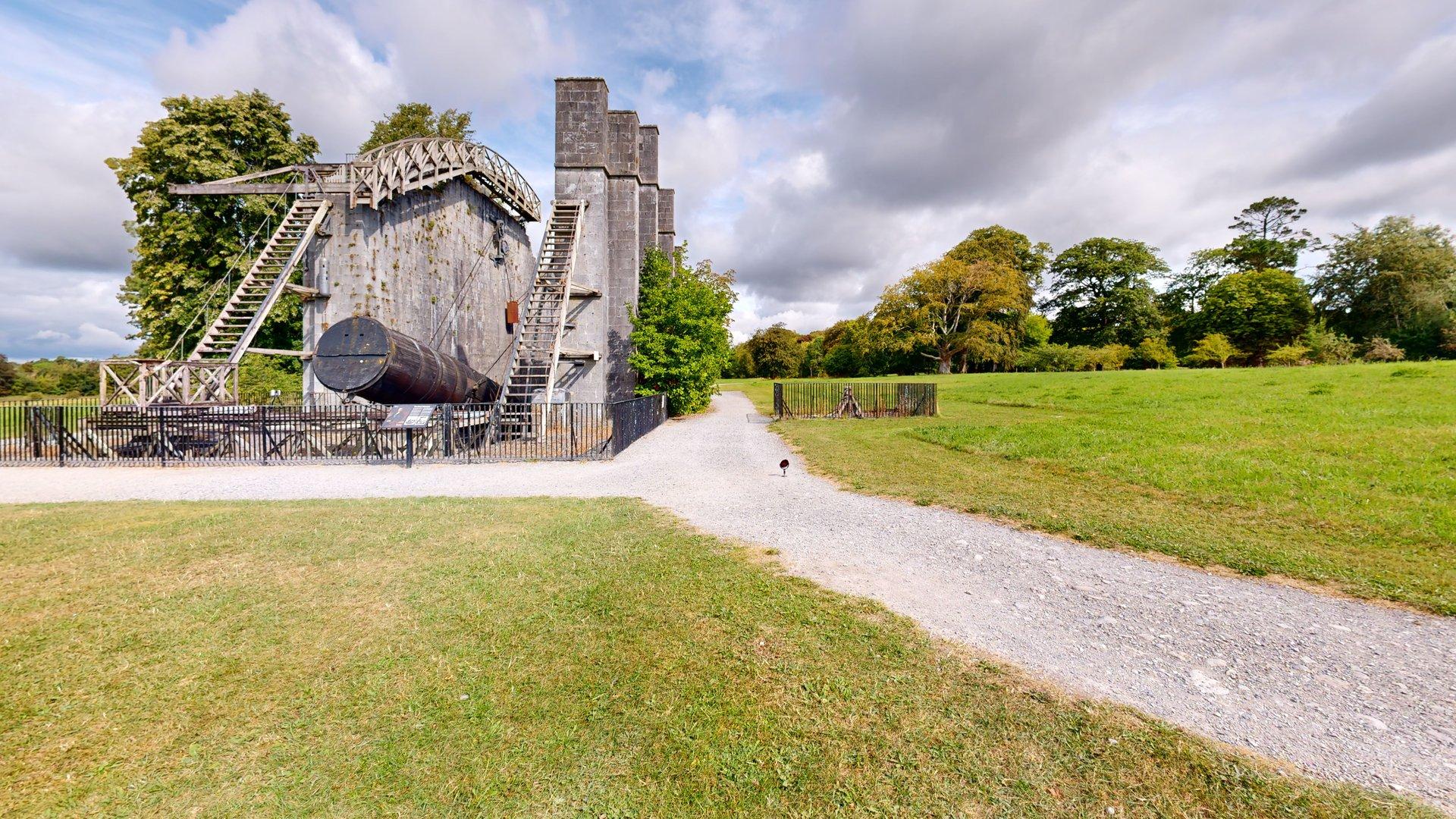
There are few better places to introduce a new piece of measurement technology than alongside one of Ireland’s greatest historic feats of scientific engineering.
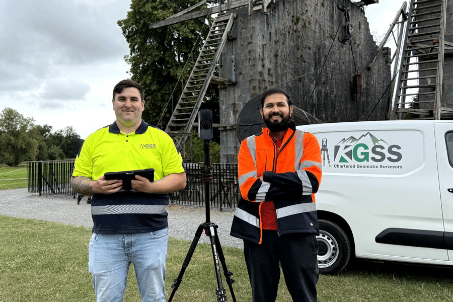
CaptureTrain recently delivered on-site Matterport Pro3 capture training for the team from Kilkelly Geo-Spatial Solutions (KGSS) at the extraordinary Leviathan of Parsonstown in the grounds of Birr Castle, Co. Offaly.
KGSS had purchased a Hitechniques Matterport Pro3 Expert Kit to add Matterport reality capture to its existing portfolio of professional surveying technologies.
Pictured during the training are Ruaidhrí Eade, Senior Surveyor, and Uqba Ramzan, Geomatics Surveyor, KGSS.
An Established Geomatics Practice Adding Another Capture Tool
Based in Co. Mayo and operating throughout Ireland, KGSS provides a broad range of geomatics and land-surveying services, including measured building surveys, topographic surveying, dimensional control, construction surveying, archaeological and heritage surveying, point-cloud capture, drafting and modelling.
For experienced surveyors, the objective of Matterport training is therefore quite different from introducing someone to reality capture for the first time.
The question is not simply “How do we use the camera?”
It is:
“Where does Matterport fit into an existing professional survey workflow, and how do we use it efficiently and correctly?”
That distinction is important.
Matterport as Part of the Surveyor’s Toolkit
The Matterport Pro3 combines LiDAR-based spatial capture with high-quality imagery to create an immersive digital representation of a site.
For a geomatics business already operating GNSS equipment, total stations, terrestrial laser scanners and other specialised systems, Matterport should not be viewed as a substitute for every existing instrument.
Its strength lies in doing something complementary.
A Matterport digital twin can provide an easily navigable visual and spatial record of a building, structure or site that can be shared with people who may never use specialist point-cloud or surveying software.
Depending upon the project and Matterport subscription, captured data can also become part of wider CAD, BIM and point-cloud workflows.
Understanding where Matterport fits – and equally where another surveying technology is more appropriate – is an important part of professional training.
Training in a Real Environment
CaptureTrain places considerable emphasis on practical capture rather than learning solely in a classroom.
The location at Birr Castle provided an excellent environment in which to discuss scan positioning, line of sight, scan density, external capture, complex geometry and the practical decisions that have to be made by an operator in the field.
The backdrop was particularly fitting.
The Leviathan of Parsonstown, designed and built by William Parsons, Third Earl of Rosse, was completed in 1845. With its enormous six-foot mirror, it became the largest telescope in the world and represented cutting-edge science and engineering for its time.
More than 180 years later, it provided an exceptional setting in which to train another generation of professionals in a very different form of spatial capture.
More Than Operating a Camera
Effective Matterport training goes beyond learning which buttons to press.
Professional users need to understand the complete workflow:
- preparing and planning a capture;
- selecting appropriate scan positions;
- managing line of sight and alignment;
- capturing complex internal and external environments;
- recognising situations that may cause alignment or geometry problems;
- reviewing the model during capture;
- understanding the relationship between capture decisions and postproduction;
- managing and presenting the completed digital twin; and
- understanding the different data products that can be generated from a Matterport model.
The aim is to create operators who understand why they are making particular capture decisions rather than simply following a sequence of instructions.
That becomes especially important when Matterport is being introduced into an established professional surveying environment.
From Capture to Postproduction
Capture is only the first stage of the Matterport workflow.
Once a model has been processed, Matterport’s browser-based Workshop provides the tools required to prepare and manage the completed digital twin, including scan visibility, labels, Mattertags, measurements, starting positions, navigation and presentation features.
For surveyors accustomed to conventional desktop applications, understanding this cloud-based workflow is particularly important.
The greatest efficiencies come when capture and postproduction are considered as parts of the same process.
Continuing Professional Development
KGSS’s adoption of the Matterport Pro3 is a good example of an established surveying practice evaluating new capture technologies and incorporating those that can add value to its existing services.
CaptureTrain provides structured Matterport training for surveyors, architects, engineers, construction professionals, facilities teams and other organisations seeking to move beyond basic camera operation and develop a repeatable professional workflow.
Training can be delivered at our facility in Athy, Co. Kildare, or – as in this case – on location using genuine projects and environments.
Sometimes those environments are considerably more memorable than others.
The Leviathan of Parsonstown certainly qualifies.
Categories
Matterport Training, Reality Capture, Surveying, Geomatics, Digital Twins, AEC, Professional Training
Tags
Matterport, Matterport Pro3, KGSS, Kilkelly Geo-Spatial Solutions, CaptureTrain, Oliver Murray, Reality Capture, Geomatics, Land Surveying, Digital Twin, 3D Scanning, LiDAR, Point Cloud, Survey Training, Birr Castle, Leviathan of Parsonstown, County Offaly
Leave a Reply